Life in one of the most biodiverse places on earth
The Map
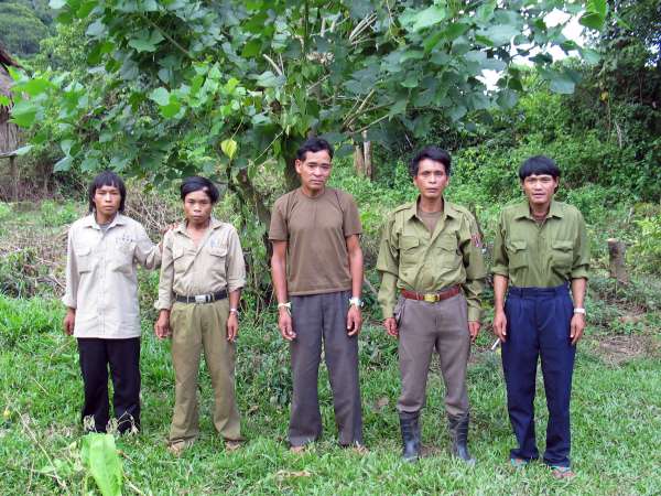
The Kri are 324 people, living in the Nakai District of Khammouan Province, Laos. The Nam Theun biodiversity conservation area is one of the most biodiverse places on the planet… The Kri live deep inside this place and rely almost entirely on the forest that surrounds them for their livelihood.
The acceptance of ephemerality and the cyclical adaptation of natural materials
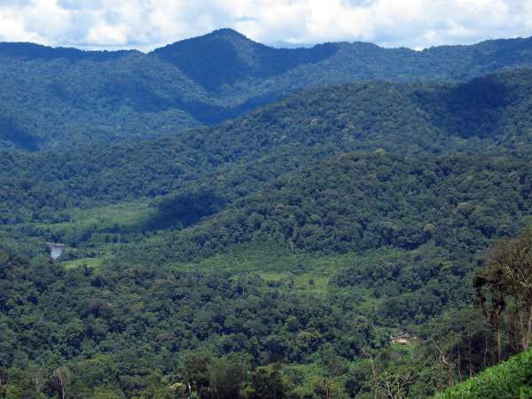
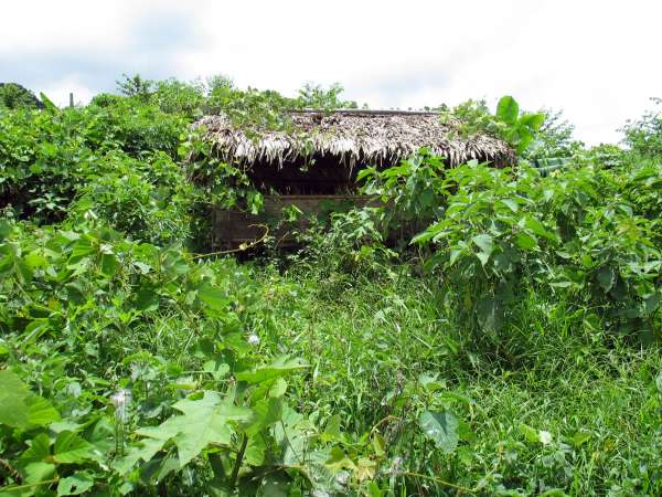
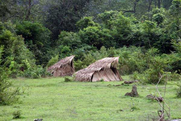
The hamlet of Mrka Từk, the most downstream of Kri settlements, is dwarfed by its upland forest watershed surroundings. Recently cleared areas of swidden field are visible along the banks of the Ñrong River: thick forest will quickly reinstate itself.
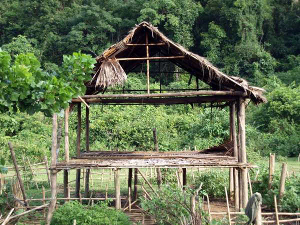
This house frame has served its purpose as a family home since its construction seven years earlier. Walling still in good condition is taken and re-used by the family in their new location in another hamlet, nearby in Kri territory.
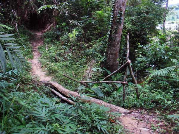
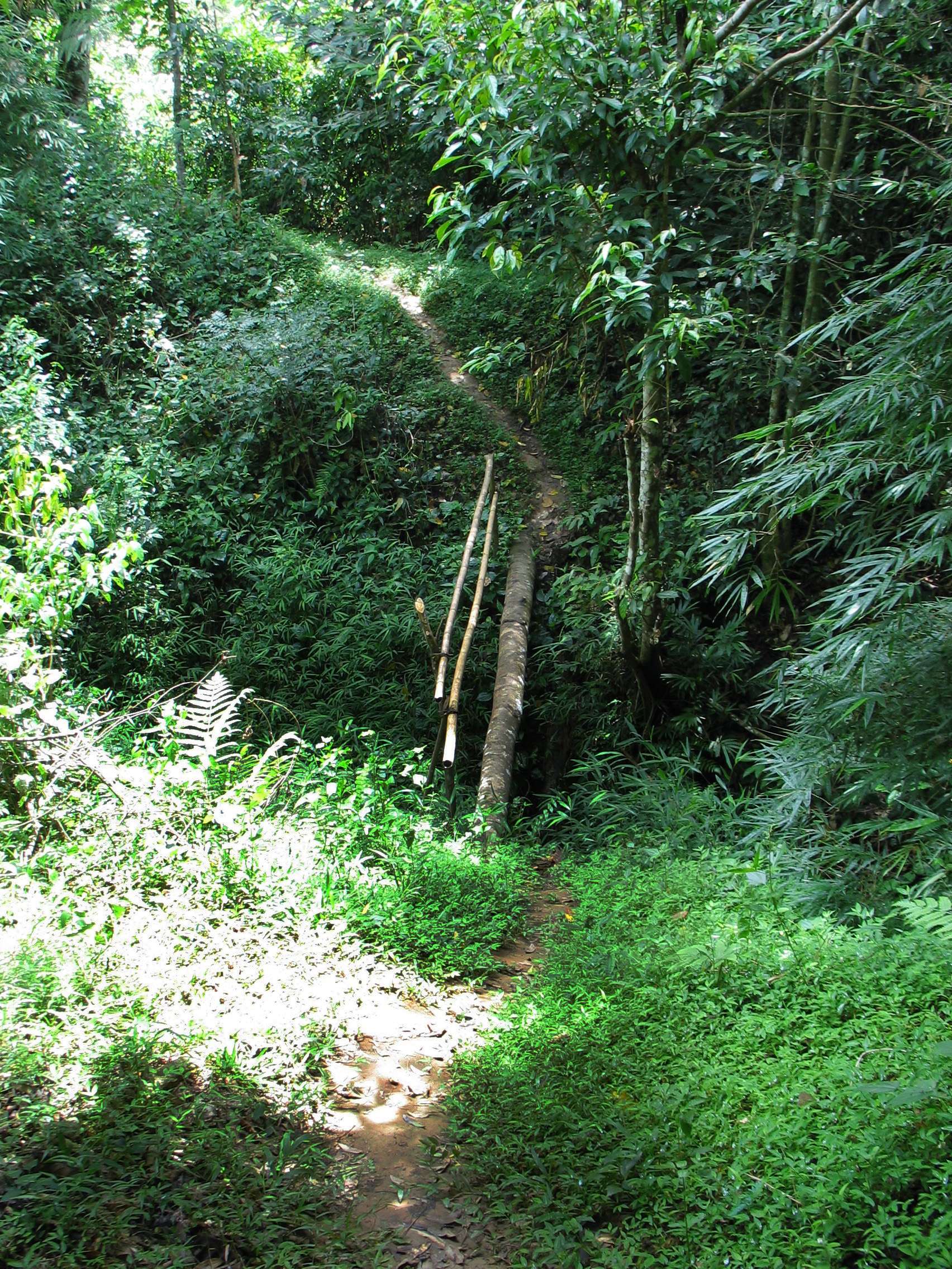
Gully crossing between village and swidden fields, Mrka VIllage. The bridge is enduring enough to serve until the end of the season: within a year it is quite likely this route will not be used.
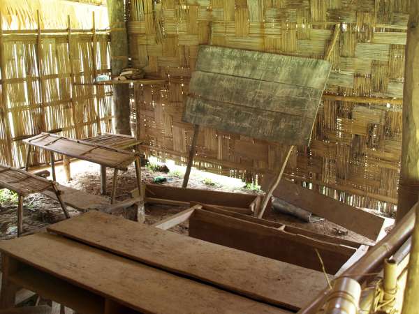
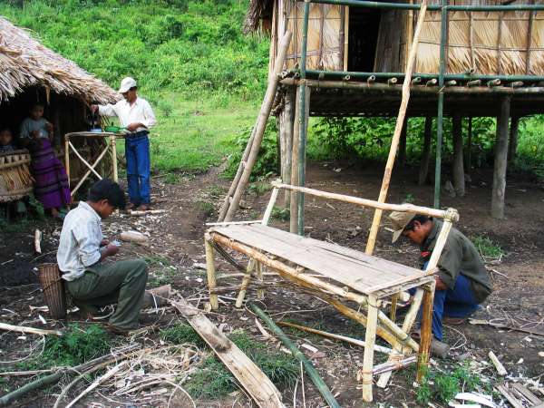
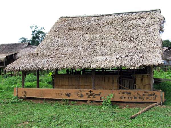
Inside the primary school at Mrka Tồồl. Light timber and bamboo materials allow quick and costless construction, and are fully biodegradable.
Field huts are constructed for short-term use during weeding, guarding, and harvesting activities by family members at swiddens distant from village home base. Once abandoned, a hut's purpose is served, and it is rapidly reclaimed.
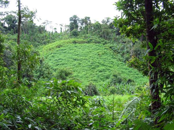
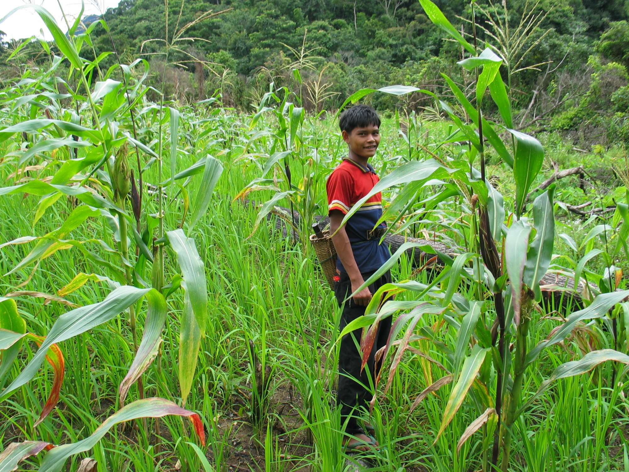
If this swidden field is not decimated by wild pigs, the cassava growing here will provide valuable carbohydrates for Kri families, either as a supplement to rice at dinner time, or boiled as a day time snack. Once utilized, this patch will quickly regenerate: within 20 years it will be hardly distinguishable from surrounding forest.
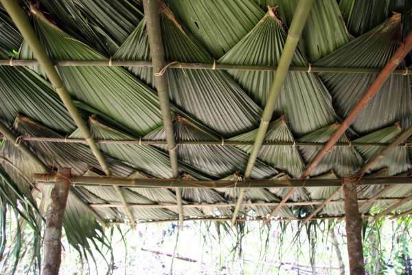
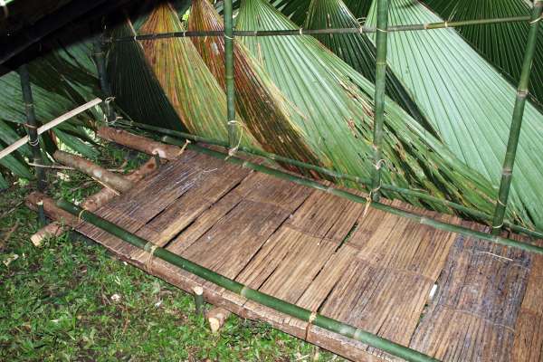
Leaves of the culoo palm (Licuala grandis) provide the thatching materials of choice in Kri shelter construction. The roofing shown here is brand new, installed a few days earlier.
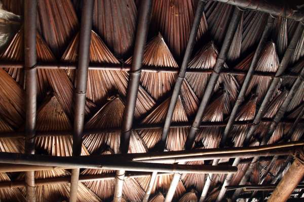
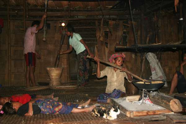
A central feature of Kri houses and field huts is a central fire pit, for cooking and warmth. The constant smoke quickly toasts the interior, coating it with soot.
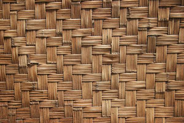
Traditional woven mat made from local reeds.
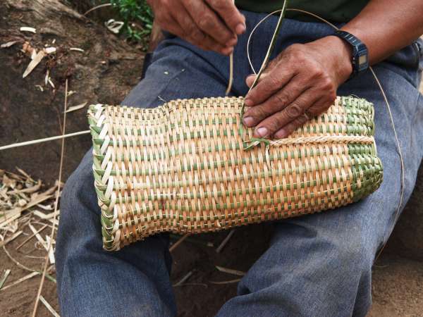
The men in the village undertake most of the weaving of vessels and baskets.
Constructing seating and a desk for the ethnographer. These deteriorated by the end of his stay in the village.
Locational and cultural isolation presents its own set of challenges
With no access to modern medicine broken arms are left to mend on their own.
Birthing huts are constructed at ground level on the fringes of village lands. The mother is attended by midwives, and is not allowed to enter any raised house until after a period of ritual detoxification.
Interior of a newly constructed birthing hut, with bamboo and timber stretcher for the mother.
Heavy fever is common in Kri territory. It usually goes untreated, the causes not diagnosed. This Kri villager did not survive.
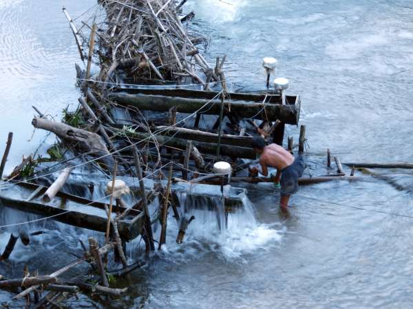
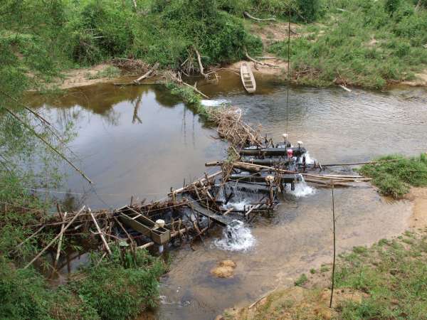
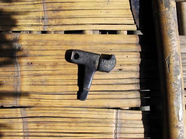
Water levels can rise suddenly in Kri lands due to heavy rains in steep-sided watersheds. Here a villager at Mrka Kơn Hamlet removes his pico-hydro unit in anticipation of damaging waterflow due to rain.
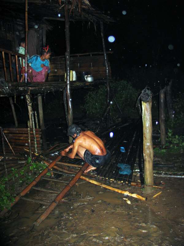
During a long night of rain, a waterlogged verandah collapses under its owner's weight. The man of the house makes emergency repairs.
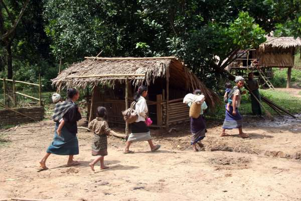
Different villages and ethnic groups of upland Nakai District rely on each other in times of need. Here, non-Kri Villagers from downstream have visited Mrka Từk Hamlet to ask for emergency rice supplies due to a poor harvest year.
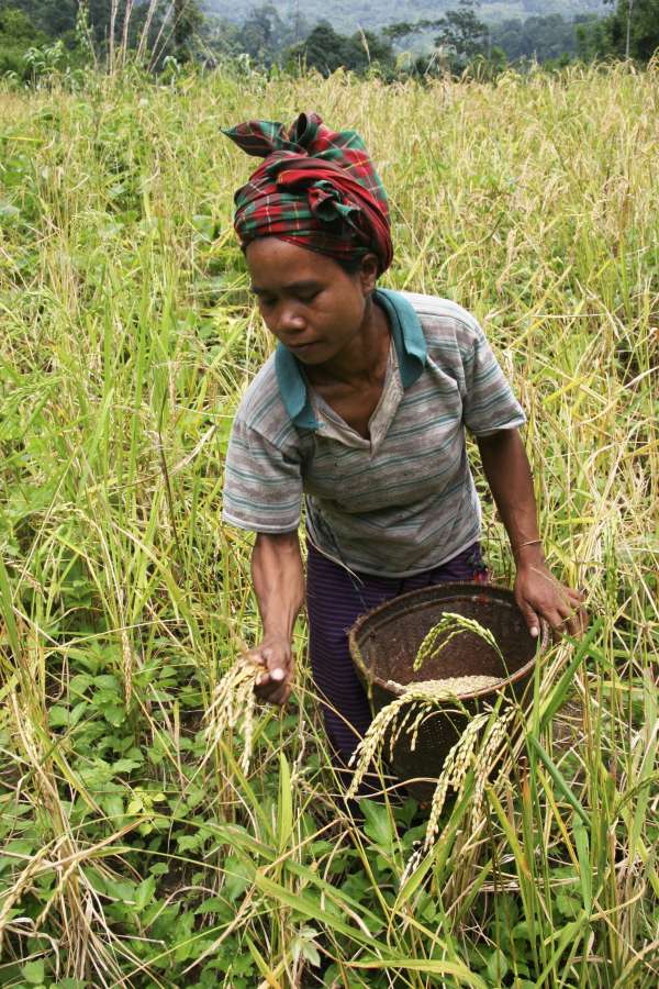
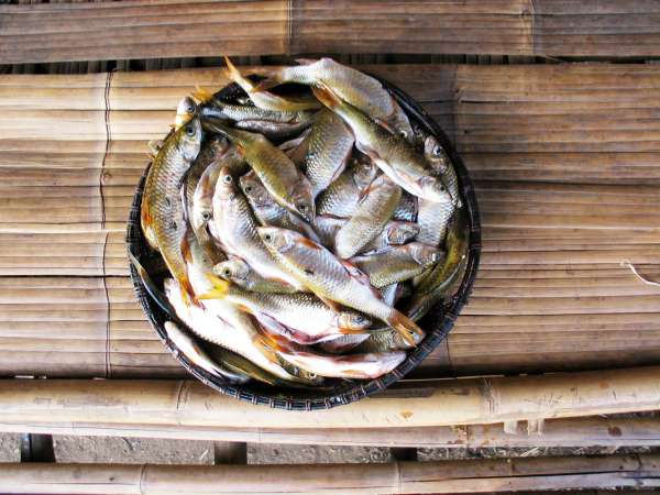
Rice is the Kri's staple grain. With no industrialised farming, every grain is picked by hand and gathering in hand-woven baskets.
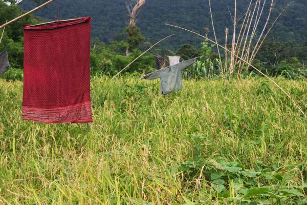
Clothing suspended from bamboo arms sway with the wind in the rice fields, deterring birds when farmers aren't around.
A villager packs provisions for a long hike downstream.
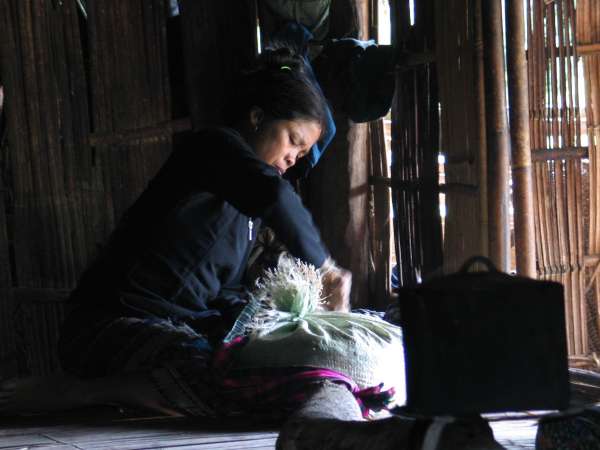
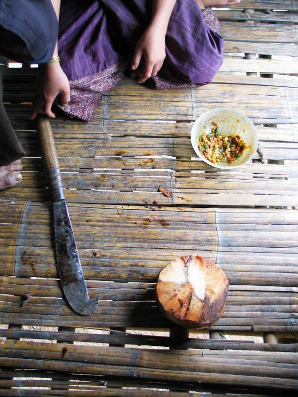
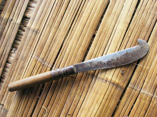
Cross section of an edible palm; villagers slice off ‘chips’ with a machete and eat them with chili paste (at top right)
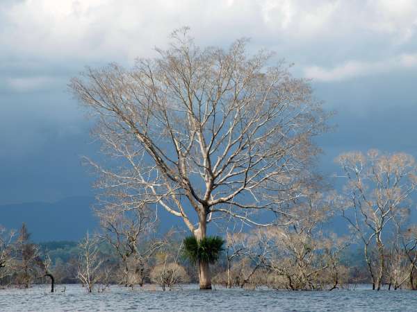
The Kri's lives are demarcated by water but the spaces they inhabit are fluid
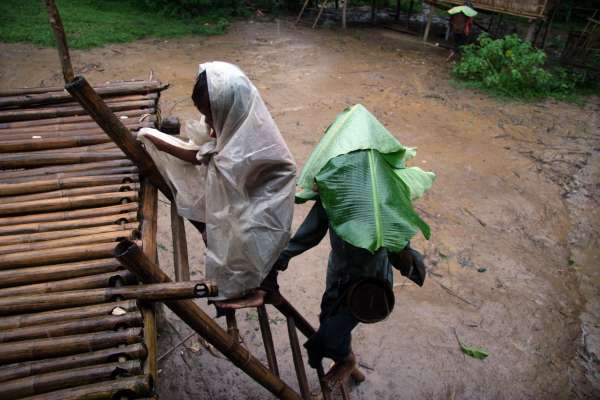
Downpour as a grandmother and grandson arrive home from a day in the swiddens.
The Paluunq Stream at Mrka Từk Hamlet, swollen after a night of heavy rain. These conditions make hauling firewood harder work than usual.
A battery of pico-hydro units at Mrka Kơn Hamlet. Each unit powers a home-interior lightbulb whenever needed.
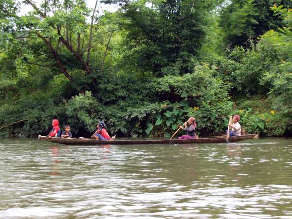
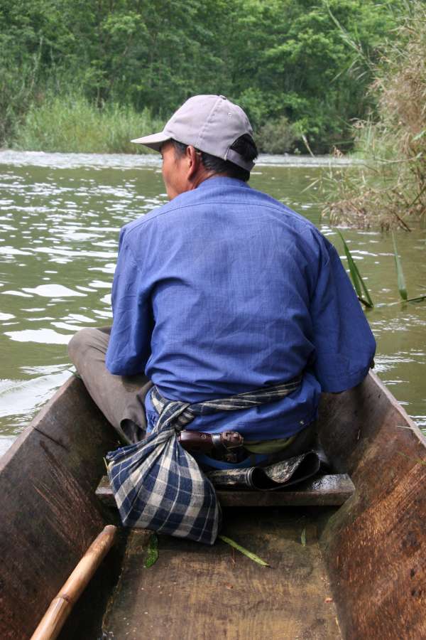
Family members at water's edge after a day's work in their swiddens wait for boats to cross the Ñrong River and return home to Mrka Kơn Hamlet.
Family members on an early morning commute to their swiddens.
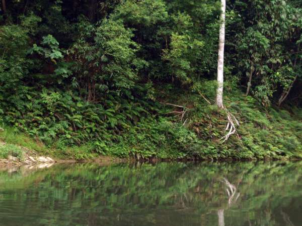
River's edge, upstream of Mrka Kơn Hamlet.
The Nakai Plateau was permanently flooded when the Nam Theun 2 Hydroelectricity Dam Project was realized in 2010. To visit the Nakai District Centre, Kri villagers would cross the plateau on foot. Today they must use boat transport.
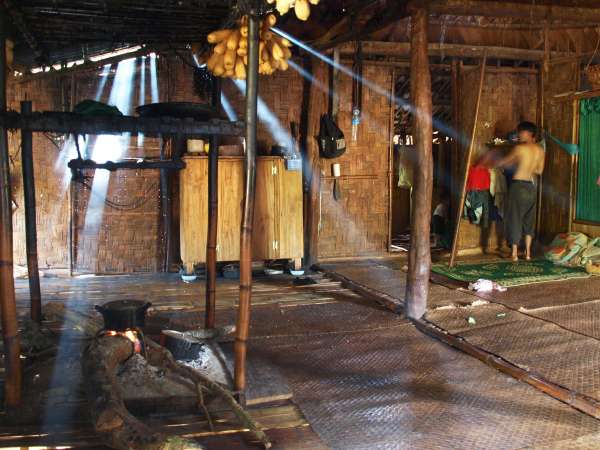
Homes do not have seperate rooms. Space is demarcated by activities.
Interior of a Kri home in the morning; father is boiling water for tea before heading to his fields
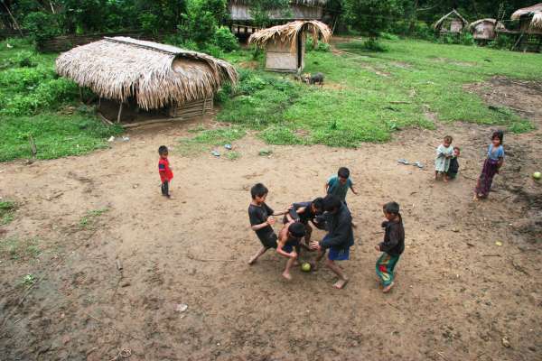
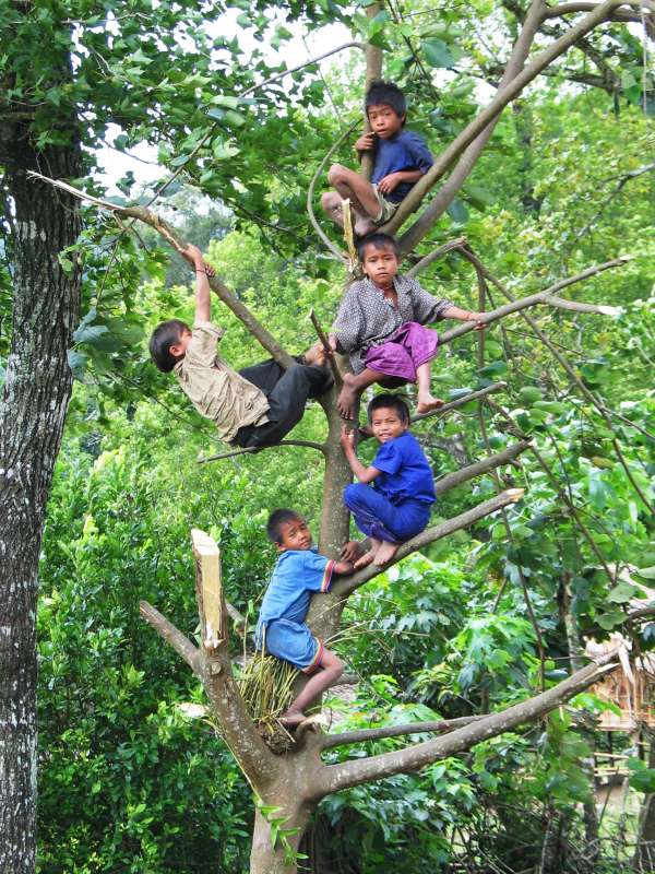
A pomelo fruit serves as a soccer ball for these Kri children.
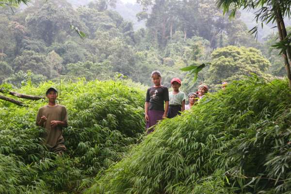
Every tree is a playground. Trees play a role in almost every aspect of life for the Kri. They can easily recite hundreds of different species from memory.
Influences and intrusions from Laos and Vietnam, the surrounding regions
Helicopter graffiti on the old school building.
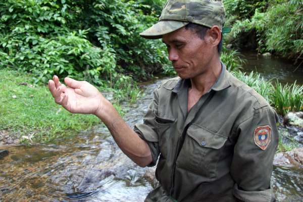
Kri territory is nestled just West of the Vietnam border. Itinerant hiker-traders are a familiar and mostly welcome presence in upland villages; trapper-hunters tend to stay off the trails, and are avoided.
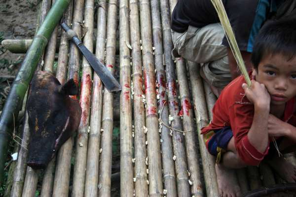
Within the last 20 years, young Kri have led a shift away from constraints on diet that are unusual in mainland Southeast Asia: older Kri prefer a fish-only diet, avoiding all red meat and forest creatures. This is rapidly changing.
District officials often visit remote villages, with a range of duties from administrative work to development projects to dealing with security concerns. While relatively safe, this frontier area is isolated enough to warrant protective measures for officials.
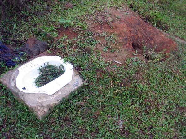
In a 2005 development project, every Kri household received a latrine kit, with instructions for installation in Mrka Village. One man per family made the four-day round trip on foot to collect the donated materials, returning to install the latrines as intended. Villagers happily participated in this as a building project; they have since continued their traditional sanitary practices.
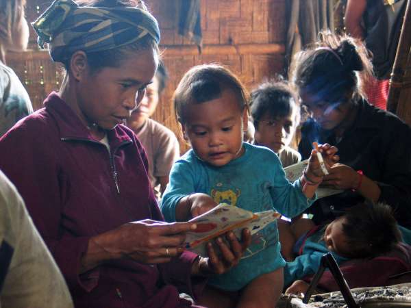
The ethnographer brings prints of photographs to Mrka taken from a prior visit: this is cause for an impromptu celebratory gathering in the village head's house. Here an aunt and niece enjoy the excitement of new photos.
This poster on an interior wall of a Mrka home was brought by VIetnamese hiker-traders. The model's head has been digitally enlarged, to reflect local norms of head-to-body size ratio.
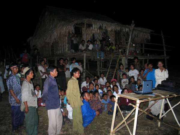
A "home video" night at Mrka Tồồl hamlet. In response to villagers' request to view his video recordings of local life and language, the visiting researcher has here set up a laptop to play a sample of recordings on a solar-charged laptop.
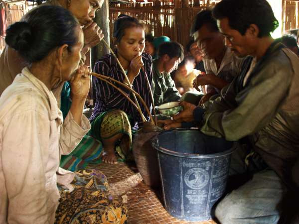
Villagers drinking fermented ‘jar liquor’ through long bamboo straws, at a festive village occasion.
In 2004 I made my first trip, as a field-working linguist, to the rugged uplands of Nakai District, in central Laos. I was to begin work on the language and culture of the Kri, an isolated Vietic community living near the Laos-Vietnam border.
The trip would mean a hike of over 14 hours through sometimes-rugged terrain, in one of the richest and best-preserved areas of biodiversity in mainland Southeast Asia: hills, rivers, and dense jungle. So I wanted to prepare well. I invested some of my prized research funding in a pair of €200 Lowe brand waterproof hiking boots. They were state of the art. But once I was on the walking trail, they created a distinct inconvenience that I had not anticipated.
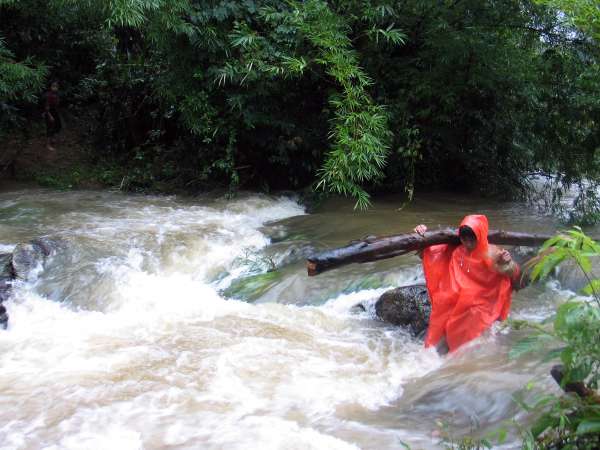
The walking trails of upland Nakai are narrow and winding, and heavily forested. With great regularity these rough trails pass through water. Sometimes these would be rivulets. In my boots, I could step over them. But other times they would be flowing streams, and a great rigmarole would ensue. Take off the backpack, set it down, find a place to sit, unlace the boots, remove them, remove the socks, bundle everything up and ford the crossing in bare feet, only to reverse the process seconds later: sit down, dry the feet, socks back on, boots back on, stand up, pack on, and finally go. The locals I was traveling with would patiently wait. They hike in one-dollar flip-flops, and water is no obstacle. They don’t seem to notice it.
When we weren’t fording streams we were teetering over deep gully creeks, on felled trees doubling as precarious bridges. Locals would cross without flinching, their rubber-clad feet gripping the uneven deck. Me? I would pause to summon up the courage and focus to take those teetering steps in stiff boots that were like clubs on the wet, curved wooden surface. With each crossing, an adrenalin burst, and a sigh of relief upon reaching the other side without falling. The locals would look on patiently.
These inconveniences annoyed me. With each hour of hiking, punctuated here and there by another wretched crossing, my internal dialogue formulated a righteous response. There should be well-built paths and sturdy crossings, just like we have in proper National Parks. I blamed it on the Lao government: why weren’t tax dollars being spent on safe, dry, paths and crossings for the country’s citizens? I blamed it on the foreign organizations who were funding hydroelectricity projects in the area: why weren’t they living up to their moral obligation to protect local populations? And finally my indignance was transferred to the locals. The average Nakai village man can build a strong and durable field hut from basic forest materials, in short time and with a machete as his only tool: why couldn’t he take the trouble to build proper crossings, if not for his own comfort, then for his family’s safety?
In a report to the Watershed Management and Protection Authority I even wrote: ‘Access in and out of the watershed is difficult and dangerous, and needs attention (most urgently, water-crossings need permanent foot bridges).’ But there was something amiss: When I spoke to locals about this, it really wasn’t a big deal for them. I couldn’t fathom why the locals didn’t care about this issue, why they had no interest in sturdy, durable, safe paths and crossings.
As my field work progressed in Kri-speaking villages, I saw more evidence of this apparent disregard for enduring, stable structure. It was spectacularly illustrated one rainy night when a pregnant mother-of-two stepped out on to the waterlogged verandah of her home and promptly crashed to the ground as the edifice simply collapsed. I watched her husband make emergency repairs by flashlight in the rain, and my mind returned to the puzzle of the water-crossings: why were the Kri settling for such transient, flimsy construction?
The next year, when hiking to the area, I had the same experience and the same thoughts on the hiking trail. But there were two differences. The first was that I left the €200 boots at home, opting instead for two-dollar gumboots. The second was that many sections of the hiking trail were unfamiliar this second time around. We took different routes along certain sections of the way. Then a year later, even more differences. And the next year, different again. By the fourth year I had hiked in to Kri territory, the accumulated changes in the path we took meant that we followed an almost entirely different route. And where we did follow the same paths, they were sometimes unrecognizable. Entire hamlets we had passed through two years earlier years were gone, the sites now abandoned and overgrown. Open crossings where plantations had been were now over head-high in vegetation. Where there had been forests, there were now clearings. It began to dawn on me. This was a world of evolving natural forces, but I was trying to see it as a world of permanence, like the world of streets, bridges, brick and concrete I call home.
I recall the moment at which my vision changed. Arriving in Kri territory after a year’s absence, we came to the mouth of the Mrka stream. This was a place I knew well. It is located at the heart of Kri-speaking territory, and it gives the Kri village its official name (Maka in Lao). But upon seeing the place this time, I became disoriented. This place was a landmark to me, a broad and fast-flowing brook that welcomed us into Kri territory proper. But there was no flow at all—just a shallow pool. My hosts explained: the wall of the tributary just upstream had eroded and recently collapsed completely. The tributary now spilled out further upriver and no longer flowed below that point. I had viewed this brook like I viewed the average concrete-walled stormwater channel: immovable. So how could this river just move? Because this is what rivers do. Like paths, clearings, and biodegradable houses, they are, by nature, impermanent.
To me this was a realization but for the inhabitants of places like the Nakai protected area impermanence is their perpetual experience. Why not build a sturdy bridge? Because for these forest travelers, there was no guarantee they would ever come this way again.
This project arises from a long-term field research project (since 2004) documenting the language and culture of Kri-speaking people. This work is carried out by Nick Enfield, Professor of Linguistics at the University of Sydney. The work that has fed into this web publication was funded by the Max Planck Society (through Stephen C. Levinson’s Language and Cognition Group), the European Research Council (through the grant Human Sociality and Systems of Language Use), and the University of Sydney (through the grants Language and Rural Society in Laos and Language and Ethnicity in Contact: a Case Study in Upland Laos).